OpenFront.io contains many interesting and diverse maps which creates a different playing style for each individual map. Some maps are more built for slow expansion, some for quick expansion, some for trade and some for quicker or slower games. A game of Openfront.io is complete when 80% or more of the map has been conquered by one player.
List of Maps
New in Update 34.0
The maps below were added or reworked in Update 34.0.
Yangtze River
Upside-down-U-shaped pipe river map of the lower Yangtze. Added by crunchybbb.
Cape Cod
The Massachusetts cape with Martha’s Vineyard and Nantucket. Added by truffle383-byte.
Channel Islands
Southern California coast with the Channel Islands offshore. Added by crunchybbb.
Gulf of Mexico
The whole Gulf basin, from Texas round to Florida, Cuba and the Yucatán, with a large pool of nations. Added by LounNight.
Qing China
The classic Qing-era China map, kept under a new name after China was redrawn with modern borders. By crunchybbb.
Added in Update 33.0
The 22 maps below were added in Update 33.0.
Sol
Massive map of the Solar System. Added by RickD004.
Russia
Big-map treatment of Russia. Added by RickD004.
United States
Large country map built for the new impassable terrain feature. Added by RickD004.
Germany
With state flags. Added by SpeakIsntThere.
China
Country map, originally Qing-China themed. Added by crunchybbb; redrawn with modern borders in Update 34.0, with the original kept as Qing China.
France
Large country map. Added by RickD004.
Vietnam
Skinny country map based on Vietnam War. Added by crunchybbb.
Scandinavia
Massive European regional map. Added by crunchybbb.
Baltics
Regional map with multiple islands on edges. Added by RickD004.
Caspian Sea
Medium sized vertical lake in Central Asia, gameplay similar to Black Sea. Added by crunchybbb.
Crimea
Disputed region between Ukraine and Russia. Added by crunchybbb.
Finger Lakes
Six skinny lakes connecting to a river; located in upstate New York. Added by crunchybbb.
Gulf of Guinea
African map with central Bioko Island. Added by RickD004.
Hecate Strait
Strait located in British Columbia; full of fjords. Added by Liam Langford.
Irish Sea
Three landmasses surrounding the Isle of Man in the center. Added by RickD004.
Levant
Three landmasses surrounding Cyprus in the middle. Added by RickD004.
Tierra del Fuego
Featuring impassable terrain. Added by RickD004.
Branching Paths
Branching fractals form waterways. Added by NotRocketfish.
More than Luck
Five-leafed clover shaped map inspired by nuke trajectories. Added by Patrick Plays Badly.
Balkhash
Pipe shaped lake in Kazakhstan. Added by RickD004.
Clearwater Lakes
Double impact crater lakes in Canada. Added by RickD004.
Las Vegas Strip
Skinny long map with roads as water and casinos as nations. Added by crunchybbb.
Continental Maps
World
Map of the World (sometimes referred to as the globe or Earth map) is a map that shows all of the 7 major continents of the world as well as all 5 major oceans of the world. This also included islands such as the Caribbean islands, the British isles, Iceland, New Zealand, Madagascar, Japan and others. The map’s terrain is comprised of an even amount of flat, hilly and mountainous terrain that is quite evenly spread through the map. However, Asia tends to be more mountainous, Africa tends to be more hilly and South America tends to be more flat. However, it should be noted that most of the map of water and with the Panama and Suez canals being a thing, this results in this being one of the best maps for trade and warships.
Giant World Map
A giant map of the World. The map’s terrain is comprised of an even amount of flat, hilly and mountainous terrain that is quite evenly spread through the map. However, Asia tends to be more mountainous, Africa tends to be more hilly and South America tends to be more flat. It should be noted that most of the map is made of water and with the Panama Canal being a thing (the Suez Canal does not exist on the Giant World Map), this results in this being one of the best maps for trade and warships.
North America
Map of Northern and Central America and Greenland. Mostly hilly and mountainous terrain with some plains mostly near oceans and in the northern and eastern parts of the map. There are a lot of water and rivers.
South America
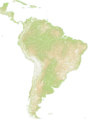
Map of South America, Central America, Florida, and the Caribbean. Mostly flat and mountainous, with some hills mostly in Brazil. Decent amount of water and has the Panama canal, in addition to rivers, making the map good for trade.
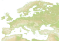
Europe
Map consisting of all continental Europe, as well as nearby islands such as: Great Britain, Ireland, Iceland, Corsica, Sardinia and more. It also shows parts of north Africa and a small part of west Asia. The map’s Terrain is mostly flat in the eastern and central regions of the map. However, Scandinavia and the Alps are quite mountainous regions, with areas such as Türkiye and Spain being quite hilly and mountainous. It doesn’t include Iceland because the map is a bit stretched compared to the old one. However, it should be noted that while nearly all of the map (except the western side) is land, but due to the Mediterranean Sea and Baltic Sea, and rivers, it is quite a great map for ports.
Europe Classic
This map is a duplicate of the older Europe map without rivers. It is not stretched out like the other maps in the game as well. This map has been added because some players’ devices don’t have enough resources to play the new map, and also because the new map excludes Iceland.
Asia
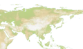
Map of all of continental Asia, as well as it’s nearby islands, such as Japan, Indonesia, the Philippines and Sri Lanka. It also shows parts of east Africa as well as eastern Europe. The map’s terrain is quite flat in the north, but in the central regions of the map (such as Tibet/west China and Kazakhstan) there are mountains that are difficult to invade through. However, most of the western side of the map is hilly with a few sparse mountains. Areas other than the north that are also flat are: Indonesia, India, east China and south east Asia. However, it should be noted that most of the map is land, but due to long coastlines and islands, building ports is a great strategy.
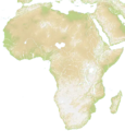
Africa
Map of the African continent with parts of the Italian peninsula, Middle East, and Mediterranean. Terrain is very hilly and mountainous, making spread slow. Africa also has long rivers allowing for trade farther inland via a port.
Oceania
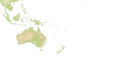
Map of Oceania and part of South East Asia. This map is mostly water. Mostly plains and hills with some mountains mainly in the northwest. The east of the map is mostly ocean but there are some small islands which makes it good for trade via ports.
Regional Maps
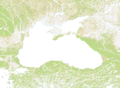
Black Sea
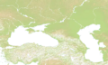
Map of areas surrounding the Black Sea. Mountains everywhere with most of the plains in the northwest and southeast. Center of the map is dominated by water and there are several rivers going across the map. It has the island of Crimea, but most of the map is land. So, it is somewhat harder to attack in the map outside of Crimea. Most of the map is mountain: the flattest part is in the Southern District area of Russia.
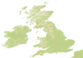
Britannia
Map of the British Isles (Great Britain and Ireland) with a segment of northern France (the Pas-de-Calais).
This map also features historic British kingdoms and lordships (making it the one with the coolest flags!).
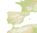
Gateway to the Atlantic
Map of Spain, France, Gibraltar, and Northwest Africa. It has lots of rivers. The nations there include French and Spanish provinces, as well as ones with names such as “Baguettes”, “An anti pope”, “Wine”, and “Sardines,” referencing French cuisine and history.
Between Two Seas
Map of the mountainous region between and around the Caspian sea and the Black Sea.
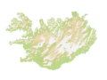
Iceland
Map of the country Iceland. It’s mountainous and it has a coastline riddled with fjords and inlets. That makes it not only suitable for land attacks but also for trade.
East Asia
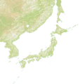
This is a map with a large amounts of water and two large landmasses: Kyushu and the Korean Peninsula. Previously named Japan and Neighbors.
MENA
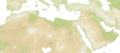
Map of Middle East and North Africa, with some parts of Southern Europe visible. Mostly hilly terrain with most of the mountains present in the northern part of the map. There are some water and rivers.
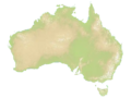
Australia
Map of the country Australia. It’s especially suitable for land attacks, as the map is one big island and one smaller island named Tasmania.
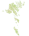
Faroe Islands
Map of the Faroe Islands, a real life island cluster located in the north Atlantic sea, between Iceland and Great Britain. It is currently under the Kingdom of Denmark. The map itself presents a lot of waterways and it is a good map for naval invasions and trading via ports.
Falkland Islands
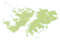
Map of the Falkland Islands located outside of Argentina.
It consists of two main islands, surrounded by water on all sides. There are plenty of tiny islands scattered around the main islands.
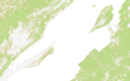
Baikal
Map of Lake Baikal in Siberia, Russia.
It features two sides of the lake, with a large body of water between. In the teams mode this map can tend to become a slow fight fought mostly with nukes as the shore can be well protected with warships.
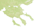
Halkidiki
A map based on where Greece meets the Aegean Sea in the north.
It features three fingers of land, with plenty of water around it.
Italia
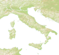
Map of Italy, Sicily, Sardinia, Parts of Balkans, and Parts of the Iberian peninsula. This is great for land attacks, since mostly is just on one land. But when on islands, warships are great for attacking.
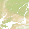
Yenisei
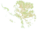
A mess of rivers, land, and islands.
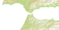
Strait of Gibraltar
Map of the Strait of Gibraltar.
Two pieces of land separated by the naturally occurring Strait of Gibraltar.
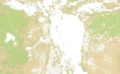
Montreal
A map of a city in Canada home to 1.7 million people. It has some Islands and water.
New York City
This is a map of New York City, home to 8 million people, has 5 peices of land (boroughs) Manhattan, Queens, Bronx, Staten Island, and Brooklyn. Bronx is cut off in this map, but it shows some other parts of Long Island and New Jersey. The most islandous are south of the Long Island. Governors Island is also shown in the middle.
Arcade Maps
As of Update 33.0, arcade maps include More than Luck, Branching Paths and Las Vegas Strip (see Added in Update 33.0), and arcade maps now appear in all playlists. Since Update 34.0, Labyrinth turns up less often in public rotation, and Chopping Block and the cosmic map Luna were removed from public rotation entirely.
Other Maps
Pangaea
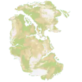
Map of the old continent Pangaea, which already broke apart in real life. It has a few rivers here and there. This map is optimal for land attacks, as there is only one continent, and it is easy to attack other parts of it.
Mars
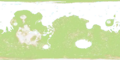
A map of what Mars might’ve looked like if it had water on its surface.
Deglaciated Antarctica
This map consists of Antarctica without ice. This leads to the landmass becoming a huge archipelago as the ice no longer connects the landmasses together, making it the map with the most island in the entire game.
Pluto
A map of the planet Pluto if it was converted into water and land. There is a bunch of islands at the north, so it will be great for boat shipping thing whatever.
Unused Maps
This section is dedicated for maps that have previously been available, but no longer are.
It could be related to tournaments, events, or maps that are retired.
Known World
This is a map that has been taken out from the available list of maps to play on. It was previously listed under “Other Maps”.
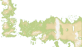
It contained two bodies of land both with surrounding water, based on the book series A Song of Ice and Fire by George R.R. Martin that is also the inspiration for Game of Thrones.
Maps and Images
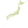
The height maps are terrain maps. These maps show water as grey-white. The colors are different depending on the terrain, with green for plains, Khaki or Tan for highlands and desert, and white for snow, ice, and mountains. The images can update to remove smaller blue things and add green, white, or Khaki or tan things that got erased by the white.
-

-
-

-
-
-
-

-
-
-
-
-
-
-
-
-
-
-
-
-
-
-
-

-
-
-
-
-
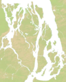 Yenisei height map
 -
 Montreal height map
 -
-
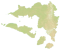 Achiran height map
 -
Reminders
-
Reminder to Add more maps to this page when the update adds any!
-
Reminder to add height maps for all new maps (find them in Github resources > maps > yourmapThumb.webp) Outdated!
Summary
OpenFront’s maps are intresting and diverse. From regular maps to Reigonal maps and even Arcade Maps, OpenFront’s maps cover a vast variety of reigons and continents. The game might add some more!
See also
More maps
Further maps available in OpenFront, each with its own page:
- Achiran — fictional map
- Aegean — European and Asian map
- Alps — European map
- Amazon River — South American map
- Antarctica — Antarctic map
- ArchipelagoSea — European map
- Arctic — cross-continental map
- Baikal — Asian map
- Baja California — North American map
- Balkans — European map
- Bering Sea — Asian and North American map
- Bering Strait — Asian and North American map
- Bosphorus Straits — European and Asian map
- Britannia Classic — European map
- Caribbean — North American map
- Caucasus — European and Asian map
- Central America — North American map
- Chopping Block — arcade map
- Conakry — African map
- Danish Straits — European map
- Didier — arcade map
- Didier France — arcade map
- Dyslexdria — world map
- Four Islands — fictional map
- Great Lakes — North American map
- Gulf of St. Lawrence — North American map
- Hawaii — Oceanian map
- Hong Kong — Asian map
- Indian Subcontinent — Asian map
- Juan De Fuca Strait — North American map
- Korea — Asian country map
- Labyrinth — arcade map
- Lemnos — European map
- Lisbon — European map
- Los Angeles — North American map
- Luna — cosmic map
- Manicouagan — North American map
- Mare Nostrum — cross-continental map
- Middle East — Asian map
- MilkyWay — cosmic map
- Mississippi River — North American map
- Montreal — North American map
- Nile Delta — African map
- Northwest Passage — North American map
- Onion — arcade map
- Passage — fictional map
- San Francisco — North American map
- Sierpinski — arcade map
- SoutheastAsia — Asian map
- Strait of Hormuz — Asian map
- Strait Of Malacca — Asian map
- Surrounded — fictional map
- Svalmel — fictional map
- Taiwan Strait — Asian map
- The Box — arcade map
- Titan — cosmic map
- Traders Dream — fictional map
- Two Lakes — European map
- Venice — European map
- Warship Warship — arcade map
- World Inverted — world map
- Yellow Sea — Asian map
- Yenisei — Asian map